Survey department was established (opened) in 2009, six years later (1n 2015) under the administration decision (order) of Erbil technology institute its(his) name (title) was changed to Surveying Department. Continuously every year, a group of students are graduated from this department, and they are awarded a technical diploma certificate in the field of technical survey. Until today, about 500 students have been graduated and prepared (qualified) to be employed by the government and private sector institutions of Kurdistan society, to benefit from their technical and scientific abilities. In the academic year 2017-2018, the teaching staff of surveying department that holding Ph.D., M.Sc., high diploma, B.Sc., and technical diploma are as shown in the table below, who continuously and every year are working to increase and improve the abilities of all the staff in terms of scientific, administration and technical aspect, the table below illustrates the number of teachers and technicians for surveying department according to their certificate: PH.D M.Sc. High Diploma B.Sc. Technical Diploma 1 7 1 5 5 In the first year and first semester, students will study five subjects divided in 20 hours per week which is include 9 theoretical hours and 11 practical hours. At the second semester in the first year they study five subjects divided in 20 hours per week which is include 8 theoretical hours and 12 practical hours. Also in the second year and third semester, students will study five subjects divided in 20 hours per week which is include 7 theoretical hours and 13 practical hours. At the fourth semester in the second year they study five subjects divided in 20 hours per week which is include 4 theoretical hours and 16 practical hours.
Weekly, our students apply scientific tests and practice in laboratories all practical subjects including computer applications, Engineering drawing, GIS and cartography, photogrammetry, CAD techniques, Remote sensing, also applying all practical survey subjects including fundamental of surveying, plane surveying, land surveying, construction surveying, Geodesy surveying and applications of surveying in the field. For this purpose and according to our ability every year the latest laboratory instruments are provide and continuously attempts are taken to improve the laboratories. In addition, students will try to train for using of latest instruments like, Differential GPS, Total station, theodolite, all types of levelling devices, photogrammetric instruments, designing software, drawing board to get full experience about projects and investment. For further practicing of theoretical and practical subjects which students have taken to study in the institute, for the purpose of broad their abilities, in the fourth semester at the second year students are take eight weeks of practical training in their majority at governmental or private sector institutions, to help them to increase their ability in scientific, administrative and technical aspects to serve Kurdistan region community.
Vision
The department intends to offer the preparation and to take care of intellectual interest needed for graduate studies and research.
survey instrument and software technology throughout the region, and to make the significant contribution to the need of the growing development.
Mission
The department of surveying aims to be a leader in providing the highest quality of technical diploma education available in the region. The task is to provide all students the opportunity for a broad-based educational experience, enabling students to address comprehensive practical surveying problems. In addition, the department seeks to provide students with the fundamentals (theory and practical) necessary to advance in the profession in response to changing technology and development expectations.
The department intends to offer the preparation and to take care of intellectual interest needed for graduate studies and research.
Department Council
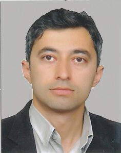
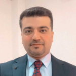
Sadiq Ramazan Younes
First Semester | |||||||||||||||||
|---|---|---|---|---|---|---|---|---|---|---|---|---|---|---|---|---|---|
| No. | Subject | Code | Theory (hrs.) | Practical (hrs.) | Tutorial (hrs.) | Hours /Week (hrs.) | ECTS | Workload (hrs.) | Subject Type | Language | |||||||
| 1 | Kurdology | KUR101 | 3 | 3 | 5 | 135 | General | Kurdish | |||||||||
| 2 | English Skills | ENS102 | 2 | 2 | 4 | 6 | 162 | General | English | ||||||||
| 3 | Computer Essentials | COE103 | 3 | 3 | 5 | 135 | General | English | |||||||||
| 4 | Mathematics | MAT104 | 2 | 2 | 4 | 6 | 162 | Assist. | English | ||||||||
| 5 | Fundamental of Surveying | FUS105 | 2 | 4 | 6 | 8 | 216 | Core | English | ||||||||
| 6 | Volunteering | Vol106 | 10 Hrs/ Semester | ||||||||||||||
| Total | 20 | 30 | 810 | ||||||||||||||
Second Semester | |||||||||||||||||
|---|---|---|---|---|---|---|---|---|---|---|---|---|---|---|---|---|---|
| No. | Subject | Code | Theory (hrs.) | Practical (hrs.) | Tutorial (hrs.) | Hours /Week (hrs.) | ECTS | Workload (hrs.) | Subject Type | Language | |||||||
1 | English Skills-2- | ENS201 | 2 | 2 | 4 | 108 | General | English | |||||||||
| 2 | Plane Surveying | PLS202 | 2 | 4 | 6 | 8 | 216 | Core | English | ||||||||
| 3 | Engineering Surveying | ENS203 | 2 | 2 | 4 | 108 | Core | English | |||||||||
| 4 | Engineering Drawing | END204 | 5 | 5 | 6 | 162 | Assist. | English | |||||||||
| 5 | Quantity Surveying | QUS205 | 2 | 1 | 3 | 5 | 135 | Core | English | ||||||||
| 6 | Workshops | WOR106 | 2 | 2 | 3 | 81 | General | English | |||||||||
| 7 | Volunteering | VOL206 | 10 Hrs/ Semester | ||||||||||||||
| Total | 20 | 30 | 810 | ||||||||||||||
Third Semester | |||||||||||
|---|---|---|---|---|---|---|---|---|---|---|---|
| No. | Subject | Code | Theory (hrs.) | Practical (hrs.) | Tutorial (hrs.) | Hours /Week (hrs.) | ECTS | Workload (hrs.) | Subject Type | Language | |
| 1 | Land Surveying | LAS301 | 2 | 6 | 8 | 10 | 270 | Core | English | ||
| 2 | Cartography & GIS | CAG302 | 2 | 3 | 5 | 7 | 189 | Core | English | ||
| 3 | Geodesy Surveying(GNSS/GPS) | COS303 | 1 | 2 | 3 | 5 | 135 | Core | English | ||
| 4 | Photogrammetry | CAS304 | 1 | 2 | 3 | 4 | 108 | Core | English | English | |
| 5 | CAD Techniques(Civil3D) | CAT305 | 2 | 2 | 4 | 108 | Core | English | |||
| Total | 21 | 30 | 810 | ||||||||
Fourth Semester | ||||||||||
|---|---|---|---|---|---|---|---|---|---|---|
| No. | Subject | Code | Theory (hrs.) | Practical (hrs.) | Tutorial (hrs.) | Hours /Week (hrs.) | ECTS | Workload (hrs.) | Subject Type | Language |
1 | CAD Techniques(Civil3D) | GES401 | 3 | 3 | 5 | 128 | Core | English | ||
| 2 | Photogrammetry | PHO402 | 2 | 2 | 4 | 6 | 158 | Core | English | |
| 3 | Remote Sensing | RES403 | 1 | 2 | 3 | 5 | 128 | Core | English | |
| 4 | Construction Surveying | APS404 | 6 | 6 | 8 | 202 | Core | English | ||
| 5 | Graduation Project | GRP405 | 4 | 4 | 6 | 194 | Core | English | ||
| 6 | Summer Training | SUT406 | Core | English | ||||||
| Total | 20 | 30 | 810 | |||||||
Head of Road and Surveying
Assistant Lecturer
Landscape Architecture
The College Contact Info
- Karkuk St, Erbil 44001
- [email protected]
- http://www.epu.edu.iq

